
It is all about Perspective!
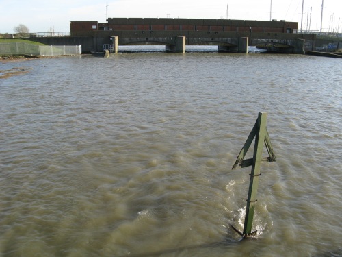
When we, Canvey Island Residents, are encouraged to believe “our” sea defences are the best, we should be aware of those in-position just across the North Sea in place to protect the Dutch.
Highlighting the Environment Agency’s deliberate warning to Castle Point Council reproduced in our previous Blog post HERE, the approach to Sea Defence Expenditure and the use of funding between the Netherlands and the UK can only be described as alarming!
Given that there are some limited levels of advance warning in place, and rather than be dismissed as scaremongering as well as advisedly, living in the Real World, we must at least, consider the damage level to property, belongings and businesses from flooding, if we are afraid to mention considering the Risk to peoples well-being!
This BBC Report from 2013 remains equally relevant today, if not even more so as the Environment Agency appear to be reminding castle point council. Unfortunately their message is destined to be confined / lost amongst, CPBC planning paperwork.
The more than strong hint from the Environment Agency regarding local authorities being involved in fund raising future Sea Defence improvements, failed to make mention in the Castle Point Council’s 2017/18 Budget setting. Indeed it is noted that the level of Sea Defence in the UK is limited by Pragmatism!
With house prices at the current levels it is “concerning” to encourage young families to commit to the level of debt required to purchase homes in an area which is Sustainably questionable.
The North Sea floods of 1953 claimed 307 British lives. In the Netherlands, the dead numbered more than 1,800.
Since then, the Netherlands has developed some of the best flood defences in the world while experts believe parts of the UK coastline remain vulnerable.
The total spend on defences on the east coast in Lincolnshire, Norfolk, Suffolk and Essex was £250m in 10 years.
In the Netherlands, 0.1% of the entire gross domestic product – between 500 and 600m euros (£420m to £513m) – is spent on a network of sluices, locks and barriers.
The job of improving those defences – by making them bigger, using newer technology, widening rivers and building floating homes – is ongoing.

The Dutch approach has been possible through taxation and a cultural commitment to flood defences as a communal responsibility.
Peter Glas, the president of the Dutch Association of Regional Water Authorities, said people in the Netherlands treated flood defence as a “collective” responsibility and rarely flinched at the idea it costs each person a few hundred euros each year.
“I think it goes back to the (1953) disaster,” he said.
“There was a national feeling of “never again” and that we should safeguard our nation and population from such threats from the sea and rivers.
“That has been translated into these very high standards of defences.”
‘Imperfect, but pragmatic’
Asked whether he felt the Netherlands was better prepared for a similar surge, Mr Glas said: “It is not for me to say.
“But I think they (the British authorities) should be aware of the problems and the threat.
“The Netherlands has a standard which should safeguard our land from the kind of storms you can expect in one in 10,000 years.”
The level of protection offered by the Dutch defences is far higher than in the UK.
Even London, the best protected site in the country, pales in comparison with the level of defences built in the Netherlands.
The UK capital’s defences – which includes the Thames Barrier – are equipped for a one in 1,000-year flood or surge event.
Experts in the UK say the British approach has not been about building the best available defences, but balancing risk and cost.
Professor Ian Cluckie, pro-vice chancellor at Swansea University and the chairman of the Engineering and Physical Sciences Research Council’s Flood Risk Management Research Consortium, said the typical sea defence outside of the capital was designed to protect against a 100 to 150 year “occurrence”.
“Some sensible judgement has to be made about what we can, and cannot, afford. It’s imperfect, but pragmatic.”
‘Aware of the risk’
Mark Johnson, area coastal manager for the Environment Agency, said areas like Great Yarmouth in Norfolk were vulnerable.
“Yes, there could be over-topping and we would repeat all the decisions we took back in 2007, working with the police and other emergency services to make sure people are evacuated safely.
“Everybody must be aware of the risk they are living within and, if they take heed, they should be able to move safely away from the risk areas in ample time before any flood comes.”
Emergencies in the east of England are coordinated from the Environment Agency’s flood incident control room in Ipswich.
David Kemp, the agency’s flood resilience team leader, said, much had changed since 1953.
“We are actively predicting the tide every day, days beforehand.
“Thirty-six hours ahead we know how high the tide will be and compare that to predict where floods might occur.
“The idea of missing a 1953 event is unthinkable. We’d see it a long way off.
“But however high our defences are, there is always the chance that there will be a storm that will overtop them.”
An ITN news post gives a more recent insight into the vigorous defence approach adopted by the Dutch. Arnoud Molenaar, Rotterdam’s Chief Resilience Officer says his fellow countrymen are also good at thinking long-term and translating their needs in 100 years’ time into points for action today.
That’s reflected even in the huge infrastructure projects such as the Maeslantkering barrier. The manager, Mark Walraven said, although the barrier’s design takes into account future sea-level rise due to climate change, it will only be effective for about a century.
After that, they will need something even more impressive to keep the flood waters at bay.
Read and view short videos explaining the Dutch approach and levels of Sea Defence in the ITN post, HERE.

